
South Africa boasts a plethora of charming small towns (also known as dorpies by South Africans), each with its own unique character and attractions. Some names come up time and time again, but what about the ones which are often not included in the usual lists…
Here are some (lesser known) top picks and their history:
ARNISTON:


Another interesting story about this town’s name! On 30th May 1815 homeward bound from Ceylon (Sri Lanka) the transport ship Arniston ran ashore battling strong winds and currents. No rescue was put into motion and during the night the boat went to pieces. 372 passengers were drowned and only 6 survived! There were women and children on board who were all drowned. The village was then called Waenhuiskrans (wagon house cliff) from an enormous cavern eroded into the cliffs. This whole coastline is notable for its bizarre marine erosion. There is an enormous natural archway nearby.
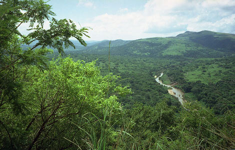
BARRYDALE:
This town lies north of the beautiful Tradouw Pass. It is named after the family Barry who were a merchant family of Swellendam and who laid this town out in 1882 as a church and trading centre on a portion of the farm Tradouws Hoek. Barrydale became a municipality in 1921.
BATHURST:


Named after The Earl of Bathurst who was the British Colonial Secretary at the time of the British Settlers. As this town was originally planned as the principal centre of the settlers in 1820 it took the name from The Earl of Bathurst. The settlers had to put up with many Xhosa raids and in 1834 the town was abandoned for a while when the raiders overran the town. In 1865 a local farmer, Charles Purdon, went to Grahamstown to a barber shop belonging to Lindsay Green. Mr Green had some pineapples from Natal. He bought some and planted the crowns on his farm Thorndon. The conditions were ideal and the cultivation of pineapples has continued since then.
CALITZDORP:


Established as a settlement for the Dutch Reformed Church developed into a town in 1821. Frederik Calitz, who owned the land, donated it to the church. It was named after him. (Dorp is the Afrikaans word for town).It received municipal status in 1911.
CITRUSDAL:


Situated on he Olifants River. Established by the Dutch Reformed Church in 1916. It gained municipal status in 1957. The name comes from the citrus trees grown in this area.
DARLING:
This town lies in the Malmesbury district. At first it was known as Groene Kloof. When the town was laid out in 1853 it was named Darling after Sir Charles Henry Darling, Lieutenant-Governor of the Cape from 1851 -1854. From 1901 it was administrated by a village management board and in 1955 it achieved municipal status.
DE DOORNS:
Small town in the Hex River Valley. It gets its name from the farm that it was laid out on. De Doorns boven aan de Hex Rivier (the thorns on the upper Hex River).Farms in this area go back to ± 1725. A village management board was instituted in 1933 and municipal status was attained in 1951.
DE RUST:


Small village between two mountain ranges. Swartberg to the north and Kammanassieberg it the south. Laid out in 1900 on the farm De Rust from which it takes its name. Rust is Dutch for rest.
GRASKOP:

Laid out between 1880-1890 on a farm belonging to Abel Erasmus, Native Commissioner of the Transvaal Republic. Named after a grassy hillock (Afrikaans ‘gras’- “grass ‘kop’hill) It was originally a mining camp. Named after the grassy hillock as a direct Afrikaans translation. It was the best place to view the edge of the Lowveld with a drop of 700 meters. Originally Graskop was a mining town. Pancakes used to be served to the miners as a cheap and filling meal and since then Graskop has become the pancake capital of South Africa.
HONDEKLIPBAAI:

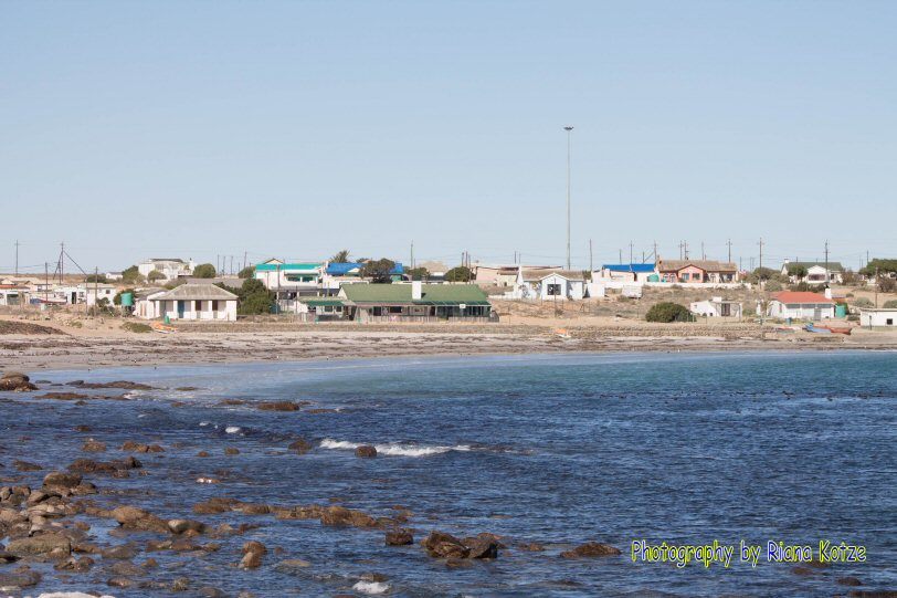
Inlet and fishing village on the west coast of South Africa. It is named after a rock which is 5m tall and resembles a seated dog until the head was struck off by lightning. Hondeklipbaai meaning ‘dog rock bay’ originated from either the fact that this area used to have a pack of wild dogs that plaques the port or the fact that the rock nearby to the small harbour once resembled a sitting dog before it was struck by lightning. The port used to be thriving before Port Nolloth and from being a crayfish factory it had to re-invent itself to an abalone farm. Both industries subsequently died. This area of the Namaqualand coastline has over ten shipwrecks giving birth to the treacherous reputation of this stretch of sailing waters, mostly misty in the early morning.
MATJIESFONTEIN:

Originally an insignificant wayside station set in the wilds of the Karoo, Matjiesfontein dates back for over a century. A young Scot, Jimmy Logan, who had been in South Africa a short while and who through his diligence and foresight, moved to Matjiesfontein with his wife and two children in 1883. He gained the refreshment room concession to supply rail and road travelers who poured through the area in ox-wagon, cart, coach and train on their way to the Kimberley diamond fields and later the gold mines on the reef. Between then and the outbreak of the Boer War he developed his village into a delightful Victorian health and holiday resort as the Karoo air was so pure and healthy. This became a camp for soldiers during the war and also served as a convalescent hospital for British officers. Jimmy Logan (James Douglas Logan) left a national treasure for everyone to enjoy to this day. The high plateau of the Karoo is 1,000 metres above sea level and the air is like dry champagne. James Logan died in 1920.
ST LUCIA:
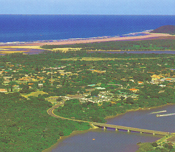
The great lake of St. Lucia. Originally named Santa Lucia by the Portuguese navigators who passed by in 1507. The members of the African Zionist Church hold services on the shore of Lake Lucia.
VANRHYNSDORP:

At the entrance to Namaqualand, this place was laid out on a farm owned by Petrus Benjamin Van Rhyn and named after him as he was the first member for Namaqualand in the old Cape Legislative Council and a leading public figure in the district. First explored by Europeans in 1662 by Pieter Crythoff and then in 1682 by Oloff Bergh and in 1685 by Simon van der Stel. Finally settled in about 1740. The farm was a good site for the town and the owner Van Rhyn offered to provide a church building on condition that all the members contributed one shilling a year towards maintenance. Township laid out in 1880 and it had a village management board in 1904.
Compiled by Sheilah McLachlan in 2011 ahead of The Expedition Project’s first road trip.


Leave a Reply
You must be logged in to post a comment.